Find your coverage
Choose an area and browse supported catalogs. Compare dates and inspect scene coverage before downloading.
 GeoD Global
LOCAL DATA. CONNECTED WORKFLOWS.
Find the right scene. Inspect the original values. Prepare the files for your next GIS project—with a desktop workspace and an Agent connected to the same core.
In development · Windows desktop · Public download not yet available
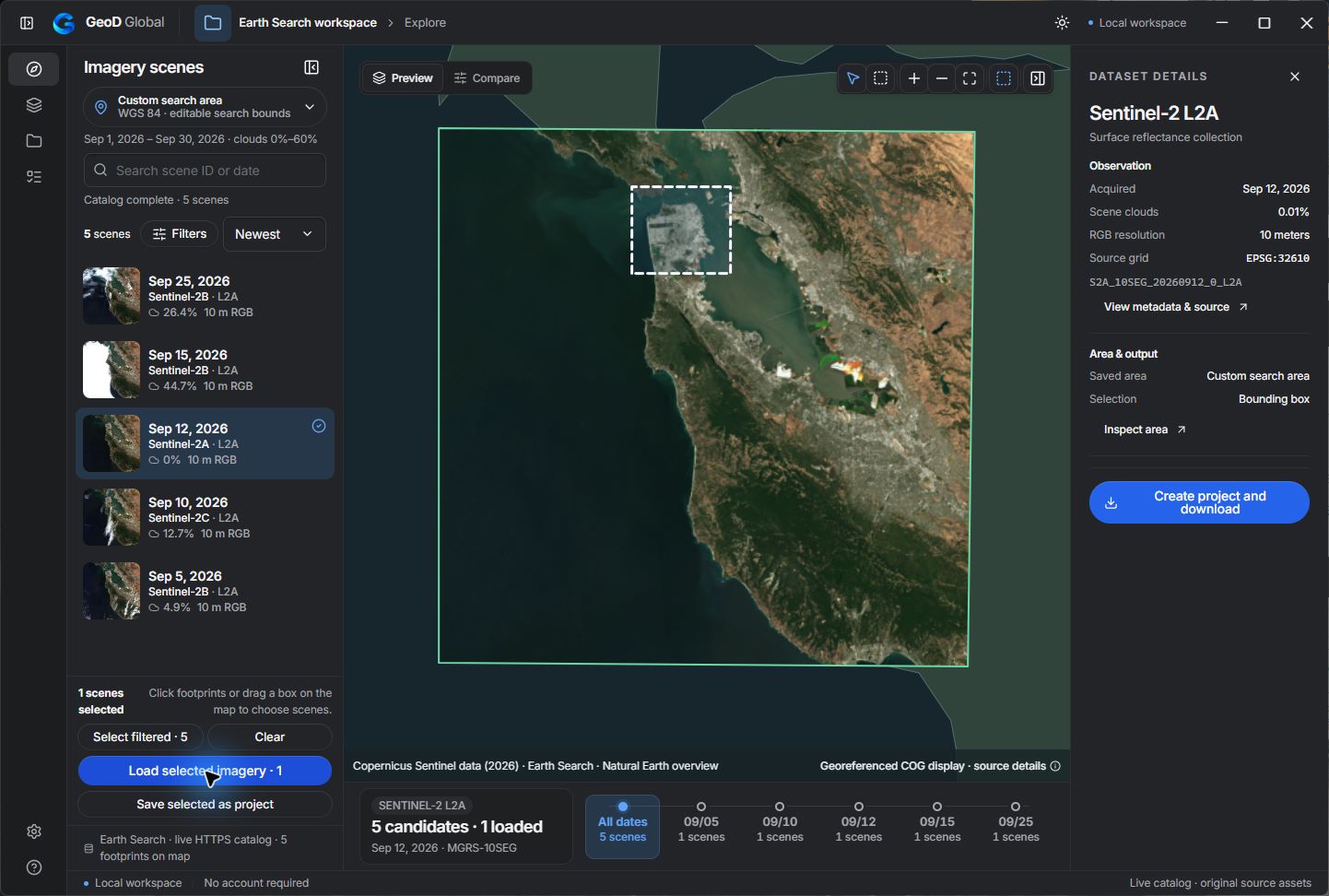
Choose an area and browse supported catalogs. Compare dates and inspect scene coverage before downloading.
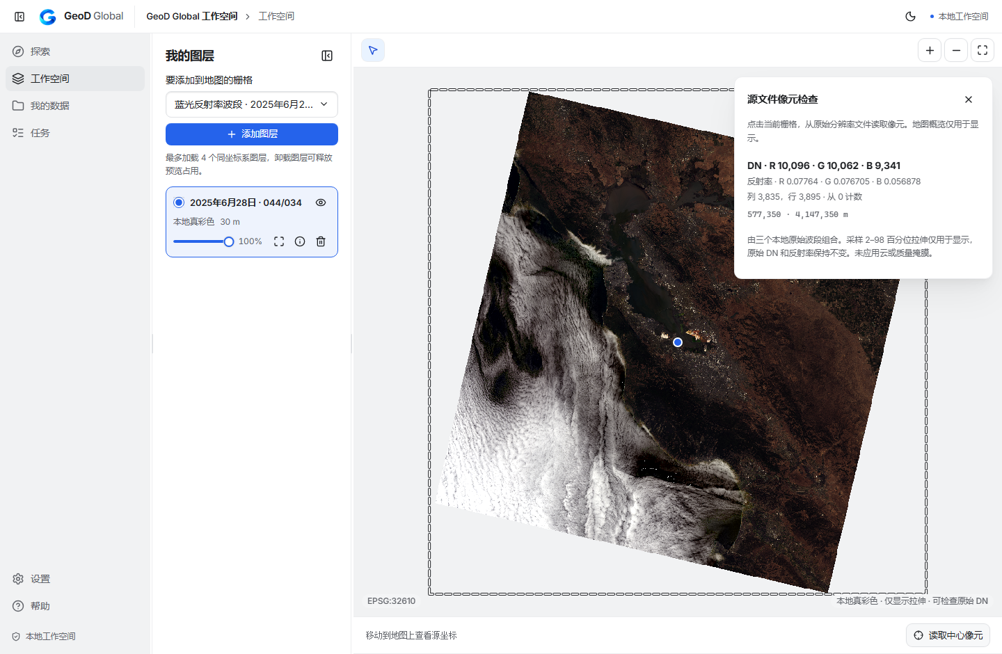
Separate source measurements from display colors. Check bands, values, and georeferencing before analysis.
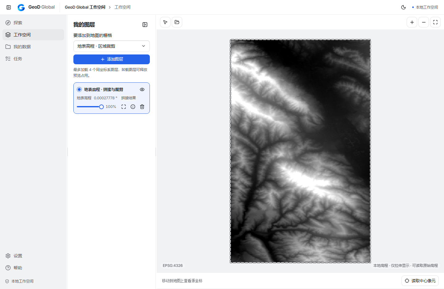
Inspect source pixels and clip or mosaic compatible rasters. Keep source files and generated GeoTIFF results together.
Let a compatible MCP client inspect jobs, plan supported operations, and run explicitly enabled tasks.
INSIDE THE WORKSPACE
For GIS consultants and researchers who prepare local data before analysis. Choose a workflow and see the files, steps, and current scope.
SENTINEL-2 L2A
Find Sentinel-2 coverage, keep selected scenes in one project, and prepare compatible raster files.
LANDSAT 8/9
Work with Landsat source bands, view them as RGB, and inspect the original values alongside the display.
COPERNICUS DEM
Bring GLO-30 Public files into a project, inspect elevations, and clip or mosaic supported grids.
These guides describe current development workflows. A public Windows installer is being prepared.
GEOD × YOUR AGENT
The desktop, CLI, and local MCP adapter share one execution core. Connect a compatible Agent client to inspect your data, review a plan, and track the actual result.
Development integration · Local MCP client required. Write tools are enabled explicitly.
geod_raster_inspect · geod_raster_pixelgeod_recipe_plangeod_recipe_run → geod_job_statusgeod_raster_inspect · geod_raster_pixelA task ID is the start, not proof of completion. Check the final task state and the saved file.
PRODUCTS, NOT JUST PLATFORM NAMES
Each dataset has its own access requirements, format, and processing limits. GeoD is an independent application.
Earth Search / AWS and Planetary Computer
Planetary Computer · local source-band RGB and pixel inspection
Elevation values, local display, same-grid clipping and mosaics
Published US coverage · local RGB and RGB/NIR pixel inspection
Planetary Computer converted COG products · processing varies by band
Account entry and download adapters in development
“Tested” refers to internal development verification. Some products require your own authorized provider account. Check access requirements and processing scope.
BUILD THE NEXT WORKFLOW WITH US
Request an early-access invitation and tell us which workflow you would like to try. No payment or release-date commitment is involved.
The development source is available under GPLv3. Installer links, system requirements, and pricing will be published when release validation is complete.
A FEW IMPORTANT DETAILS
This site introduces the product. GeoD Global is a desktop workspace; supported preparation and processing run on your computer.
Through a local MCP adapter in a compatible client. The integration uses GeoD's runtime; it does not automatically control an open desktop window.
GeoD focuses on discovering and preparing data. Continue your analysis and cartography in the GIS tools you already use.
The current release effort targets Windows. Other desktop platforms are not being announced as available.
Independent software by Gao Pengbin · Development preview · October 2026
Visit the developer on Bluesky