
What this workflow produces
A local Landsat 8/9 Collection 2 Level-2 project with B4, B3, and B2 source files, an RGB display, and source-value inspection. The RGB display is separate from a merged RGB export.
This describes the current development build. Public installation instructions will follow the verified Windows release.
From area to local project
Find a suitable Landsat scene
Use the supported Planetary Computer Landsat 8/9 Collection 2 Level-2 catalog. Review the area coverage and acquisition information for the scene relevant to your task.
Bring B4, B3, and B2 into the project
Download the red, green, and blue source bands for the same scene. Keep their product identity and source links with the files.
Display the bands as RGB
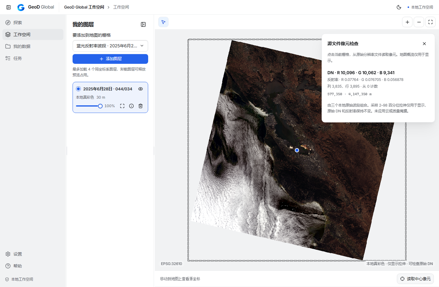
Open the supported local RGB combination. Review its geographic placement and display settings. The display stretch determines how the image looks.
Inspect the source measurements
Read a source pixel and distinguish the raw digital number from reflectance derived using the product scale and offset. Use the product's scientific and quality guidance for analysis.
Continue in the same project
Keep the source files together and return to the project for later inspection. The development workflow has been checked for local display, source values, and reopening.
Current scope
Local RGB display and original-band inspection have been verified with real source files. Merged three-band RGB GeoTIFF export, additional band combinations, and quality-mask workflows remain pending. Individual supported source bands have separate processing support.
Continue in your GIS workflow
Use the source bands in your GIS or scientific tools when you need additional analysis or quality masking. Confirm the expected scale, offset, and valid-pixel rules for the exact product.